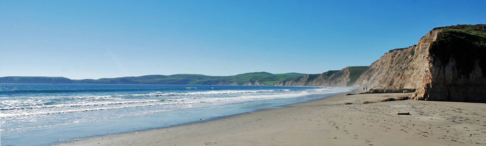
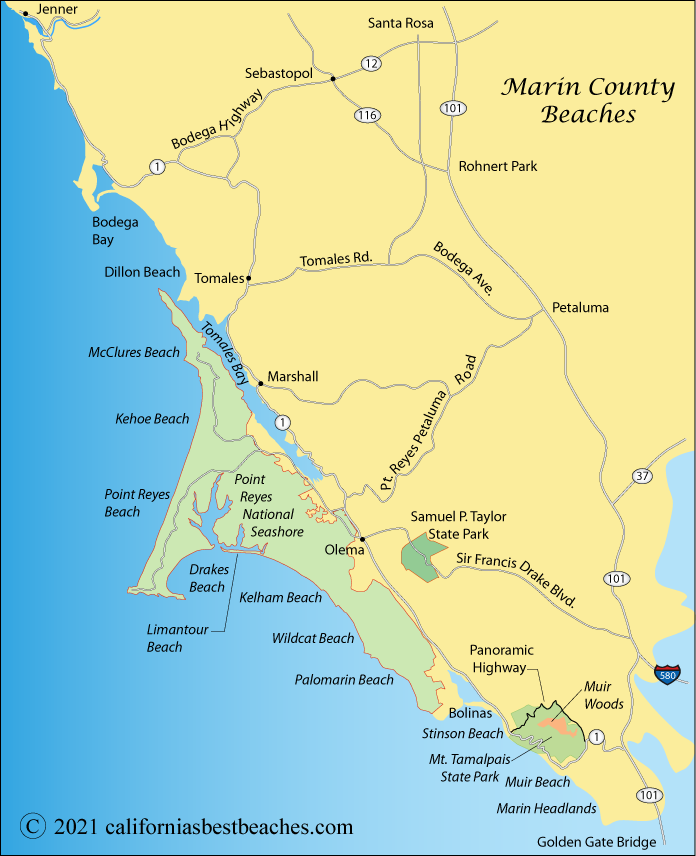
Directions to Point Reyes
From Highway 1 watch for the signs directing you to Point Reyes National Seashore. Coming from Highway 101, take Sir Francis Drave Boulevard from just south of San Rafael or the Point Reyes/Petalum Road from Petaluma.
| City | Miles | Hrs/Mins |
|---|---|---|
| Berkeley | 35 | 0:54 |
| Bodega Bay | 33 | 0:45 |
| Concord | 54 | 1:15 |
| Hayward | 55 | 1:13 |
| Mill Valley | 26 | 0:44 |
| Oakland | 40 | 0:58 |
| Petaluma | 19 | 0:32 |
| Rohnert Park | 30 | 0:45 |
| Sacramento | 95 | 1:50 |
| San Francisco | 36 | 0:58 |
| San Jose | 82 | 1:45 |
| San Mateo | 62 | 1:56 |
| San Rafael | 19 | 0:33 |
| Santa Cruz | 111 | 2:12 |
| Santa Rosa | 36 | 0:50 |
From Highway 1 watch for the signs directing you to Point Reyes National Seashore. Coming from Highway 101, take Sir Francis Drave Boulevard from just south of San Rafael or the Point Reyes/Petalum Road from Petaluma.