Guadalupe Dunes and Beach Directions

Gaviota Beach, Santa Barbara County, California

Guadalupe Dunes and Beach Directions


map of central california coast beaches, CA

Mileages and Driving Times to Guadalupe


City Miles Hrs/Mins
Bakersfield 134 2:25
Fresno 161 2:48
Lompoc 28 0:31
Los Angeles 178 2:39
Monterey 172 2:43
Paso Robles 56 0:59
Salinas 154 2:27
San Jose 213 3:24
San Luis Obispo 29 0:31
San Francisco 259 3:58
Santa Barbara 84 1:24
Santa Maria 8 0:10

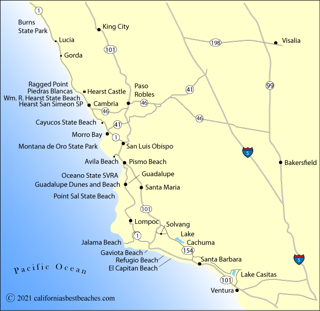
Directions to Guadalupe Dunes and Beach

From Highway 1 in Guadalupe, take W. Main Street to Rancho Guadalupe Dunes Park on the coast.

For Point Sal State Beach, from Highway 1 south of Guadalupe, turn west onto Brown Road and follow it for about 4 miles to the locked gate. Read details about the hike to the beach: Directions to Point Sal State Beach.