Garrapata State Park
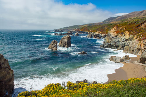
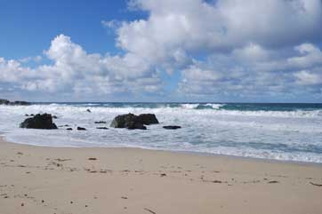
Garrapata State Park is a spectacular shoreline area at the northern end of Big Sur. Trails lead up steep mountains, through redwoods, and along the rugged coast. At the far southern end of the park is a sandy beach, but extremely hazardous surf makes it far too dangerous even for wading.
Parking, Trails, and Overlooks
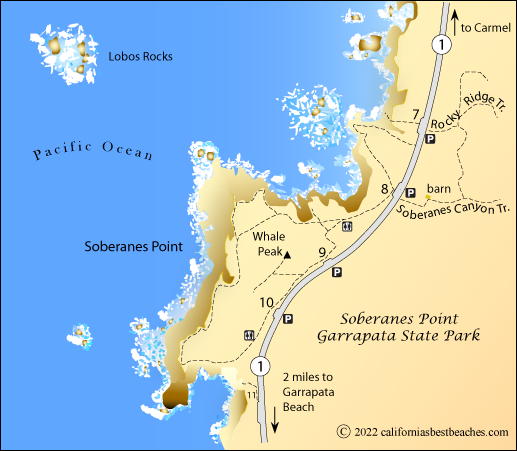
Parking is in small areas adjacent to Highway 1. A series of 19 numbered signs mark various gates and trailheads along the highway.
- Rocky Ridge Trail - Across the highway from gate sign 7. Seven miles round trip. The challenging trail climbs quickly 1,200 feet up Rocky Ridge and then descends steeply to connect with the Soberanes Canyon Trail.
- Soberanes Canyon Trail - Across the highway from gate sign 8. Hike up Soberanes Creek through redwoods and ferns.
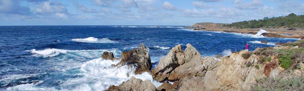
- Soberanes Point Trail - Gates 8, 9, or 10. The trail loops around Soberanes Point offering wonderful views of the coast. A side trail takes you to the top of Whale Peak.
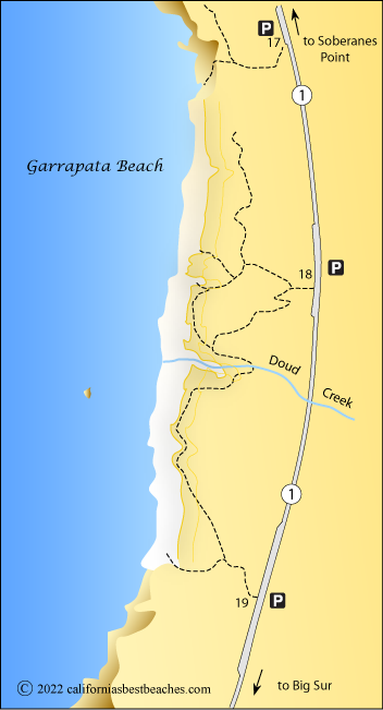
- Scenic Overlook - Pullout and bench at gate 17
- Garrapata Beach access trails - Gates 18 or 19.
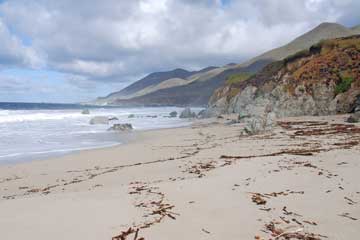
Garrapata Beach
There are no signs to mark the location of Garrapata Beach other than the three numbered turnouts along the side of the highway. The beach is 2.3 miles south of Soberanes Point. Visitors to Garrapata Beach are amazed by the beauty of this often-overlooked little stretch of sand.
Beach-goers enjoy strolling along the beach, exploring the little caves, nooks and coves in the rock. Spring and summer wildflowers are breathtaking. Doud Creek spills over the bluff in the middle of the beach and finds its way to the ocean. Garrapata Creek arrives south of the beach.
Caution: Check with rangers or lifeguards that conditions are safe for your planned activities.
Beach Access
Three parking areas along Highway 1 provide adequate space for visitors. The northern parking area (gate 17) connects to a trail that takes you to an informal overlook on the bluff. A steep, rugged side-trail leads down to the far north end of the beach - not recommended.
From the center parking lot (gate 18) several trails find their way down to the beach near Doud Creek. From the southern parking lot (gate 19), the left-hand trail leads down stairs to the beach while the trail to the right continues along the bluff.
Unfortunately there are no restrooms at the beach. Restrooms are located 2.3 miles north on Highway 1 between gates 8 and 9 and between gates 10 and 11. Clothing optional visitors head to the north end of the beach, although nudity is not in accordance with park rules.
Dangerous surf makes the water too hazardous even for wading.